A short hike into the mystical silence of Lanzarote’s desolate volcano country.

The volcanic eruptions of 1730-1736 covered a third of Lanzarote’s surface with lava, ash, and gravel. Although no one died, several small villages were engulfed and buried forever. This walk takes us to the desolate, breathtakingly beautiful centre of that momentous event.
The first volcano to be created by the eruption was the Volcán del Cuervo. If you want to visit this beautiful volcano, there’s a carpark on the LZ-56 and a well-marked footpath to the stunning crater. But for this walk, we’ll carry on the LZ-56 towards Tinguatón before parking in a large area opposite a rounded mountain on the right.
We start out by heading along the track at the foot of the longer ridge on the left, Montaña Cortijo.
You can drive along this track, but finding a parking place isn’t guaranteed, and the one-mile hike to through the lava field, with the mystical volcanoes ahead of us, puts you in the perfect mood.
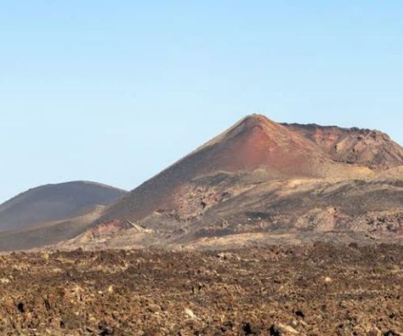
Turning away from Montaña Cortijo, we head straight across the lava field towards Montaña del Rodeo, where we turn right and skirt around the base of this volcano. Rodeo was a small village near the larger town of Santa Catalina, and we’ll see the dark peak of the Montaña de Santa Catalina to our right as we traverse the base of ridge.
At the time of the eruptions, Santa Catalina one of the most important villages on the island, home to several wealthy landowners. But on 7th September 1730, one week after the Volcan del Cuervo had appeared, the village was completely destroyed by lava.
Terrified, some of its inhabitants fled to Fuerteventura, while another 42 settled in the area now known as Los Valles, on the heights between Teguise and Haría. The images from their church are still kept in Teguise.
The exact location of Santa Catalina, Rodeo, Mazo, and other villages is unknown – they were not only buried, but the landmark hills and mountains that identified them were completely altered, too.
At the end of the ridge of Montaña del Rodeo we come to the Caldera de la Rilla on our right, and head over a gravel path towards the bottom of this mountain. It’s worth pausing for a moment to appreciate the utter silence here – the only noise you’re likely to hear is the wind in your ears and the crunch of your feet in the picón gravel.
On the far side of the Caldera you’ll see a rough path up the side of the volcano in the gravel, and it’s a short but stiff ascent to the rim. You’re now looking into the Caldera de la Rilla, the second volcano to erupt in 1730, and you’ll see a strange formation that looks like a fish or a cracked loaf a t the bottom of the crater.
Behind you, you have a magnificent view towards the highly protected National Park area, with the peaks of Montaña Señalo and Pico Partido – it’s a landscape of utter destruction, but also of a strangely moving beauty.
Returning to Montaña del Rodeo, we’d advise heading up the reddish path to the summit. It’s another strenuous ascent, but worth it for the views at the top.
Return the way you came and make your way back to the path across the lava field by going back around the volcano.
WALK INFORMATION
This is a linear 6km walk which should take you 3 hours to complete. The terrain is easy with a few steep climbs.
We strongly advise staying to the marked paths.
For regular updates, pictures and videos of Lanzarote be sure to like and follow our Facebook page “Gazette Life Lanzarote”.


