Tour Guide David Penney takes us to one of the weirdest landscapes in Lanzarote and leads us up one of the north of the island’s beautiful barrancos.

We parked at the abandoned picón quarry (antigua rofera) at the side of the LZ404, keeping our vehicles parked over to the side as it can sometimes get busy with tourists stopping off here. This place has become a magnet for people posting fascinating images on social media and I have seen several photo shoots here, some in black-and-white and others taken as night-time shots.
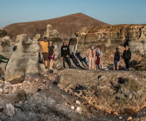
We then started exploring the old picón stacks, as many of them had created some interesting features. Some of the picón stacks had been victims to people carving them into fascinating shapes, and every time I visit, I see different names have been carved on them, I think it’s the same guy with a different girlfriend every month!
Picón is volcanic gravel which is quarried and then transported to the farmers’ fields where it is spread by hand to create a deep layer in which they grow their vegetables. Some of the local farmers refer to it as the “secret of life” because it absorbs the humidity which Mother Nature produces every day as the difference between daytime and nighttime temperatures.
The reason this quarry is no longer active is because the remaining grey coloured picon is not suitable for spreading on the farmers’ fields as it is more like an ash, and it is not porous.
You could easily spend a couple of hours exploring all of this area as every time you turn a corner you find more shapes of interest.
We follow the dirt track through the quarried area until we reach the Barranco de las Piletas which crosses the track. A barranco is a ravine carved out by running water, but on Lanzarote they are dry for much of the year. We turn to the left (north-west) and start our scramble up the dry riverbed.
The basalt rocks here have been washed smooth by the rainwater running down from the hills. We did the walk on a cloudy day at the end of our long, dry summer, but on rainy days we can get a river running down here. The barranco starts at a much higher area by the village of Los Valles and cuts across the land continuing down until it reaches the ocean on the east coast.
We continue trekking along the riverbed until it forks. It continues much further up past the village of El Mojón and up to Los Valles, but at this point we decide to start our return and have a choice of which way we can go back.
The left fork takes us back along a vehicle track which is shorter and easier and will take us straight back to the parked cars. The right fork takes us higher up on a vehicle track which is used by the farmers and the hunters. This track is a bit more challenging and is certainly longer, but it creates a circular route back round the other side of the picón area and gives an elevated view over to the east coast.
A FERTILE OASIS
We trek under a water pipe which has been erected to transfer water to a nearby finca, and we can see where the farmers had created terraces on the banks of the barranco to grow their vegetables and live off the land. Water from the barranco was the key factor in this activity and a variety of produce is grown here, including the prickly pear cactus, the tabaiba plant and several others.
This fertile area also attracts lots of insects and several different species of birds including pigeons who are nestling on the rocks, kestrels, many Berthelots pipits which are very common in areas like this, and we also saw a sparrowhawk.
WALK INFORMATION
This is a circular 4-8km walk (depending on what route you choose) which should take you approximately 1 and a half to 2 hours to complete. The terrain is fairly challenging in some places.
You can take the number 52 bus to Teseguite or El Mojón if you don’t want to use your car.
For regular updates, pictures and videos of Lanzarote be sure to like and follow our Facebook page “Gazette Life Lanzarote”.


