Tour guide David Penney used to live in Soo, and shares a gorgeous breezy route with special memories.

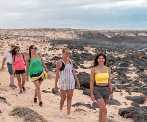
The walk starts at the Sociedad in the village of Soo, where we set out along the road towards Famara for a few minutes. As we leave the village there is a farmer’s wall on the left and immediately after it, we take the dirt track which takes us past the volcano on the left, going uphill slightly past the old abandoned finca (farm), which used to produce the local tomatoes. The track keeps the volcano on your left and the crater on your right.
We head almost north along the track towards the ocean, and as we leave the volcano behind and reach the highest point on the track, we’re rewarded with an uninterrupted view over to the coast and the small north-western islands of La Graciosa, Montaña Clara, and Alegranza. As we continue down towards the ocean, we see the spectacular cliffs of Famara over to our right.
SHELLS AND FOSSILS
It’s hard to miss millions of tiny white snail shells scattered all over the terrain here. These are land-based snails that eat the vegetation, but you can also find thousands of small, sand-coloured cocoon shaped things which are peppered on the surface and embedded in the sand. They are evidence that the island was once home to millions of hornet-type insects which lived thousands of years ago. They made their cocoons from sand and saliva and the creatures hatched from them, but climate change forced them to leave the island as it became too dry for them to produce their saliva.
We continue down the track until we see a flat metal post in the ground which is a marker for the mountain bike trail around the island. Here we drop down into a barranco (dry river bed) which still contains the bleached bones of a donkey which was washed down from the hills by heavy rains many years ago
We ascend from the bed of the barranco and join the main track again, reach a T junction and turn left along the track heading back down to the ocean. If we look away in the far distance on the left we can see the village of Caleta de Caballo and the sports complex of Club La Santa.
CRAB WATCHING
Shortly, we turn right and follow the track running parallel to the ocean, reaching an area of soft golden sand where we walk over to the rocks at the water’s edge. If we stop talking and walk gently across the sand, we’ll spot several red and black crabs sunbathing on the rocks. This area has special memories for me as this was the point where I used to rest after walking here from my home in Soo after I fractured my back in 2009. It was my goal to reach this point when I was building up my strength again.
After a short break for a banana and bottle of water we head off again with the view of the cliffs in front and the waves crashing to our left (time this stretch for high tide to get the benefit of the bigger waves.)
We pass the tiny scattering of houses on our right, known by the locals as Monique. This is a separate group of properties which didn’t get basic utilities and was never allowed to be developed.
Shortly after this we arrive at the lovely beach area called Playa San Juan, which is almost unknown to tourists, but is popular with the local surfers.
We finally arrive at the village of Caleta de Famara where a cold beer or mojito is waiting. I particularly like the vegetarian/vegan restaurant called El Sibarita, which also offers great food.
WALK INFORMATION
This is a linear 10km walk which should take you approximately 3 hours to complete. The terrain isn’t taxing – expect roads and sandy trails along the way.
You can leave a car at Famara before heading to Soo in another vehicle, or the No 20 bus will take you from Famara to Soo.
Take sun protection and water, as there is no shade on this route.
For regular updates, pictures and videos of Lanzarote be sure to like and follow our Facebook page “Gazette Life Lanzarote”.


